SANDSCAPE
Innovative tool teaches mapping concepts
East Carolina University’s Department of Geological Sciences is using a new teaching tool that accelerates students’ understanding of topographical maps and geologic concepts.
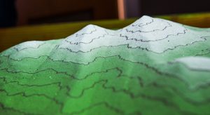
The augmented reality (AR) sandbox consists of a box of quartz sand, a projector and an Xbox Kinect 3-D camera connected to a computer running an open-source software program developed at the University of California, Davis. The camera’s infrared sensors detect the shape of the sand in the box, and a topographic map of the landscape is projected onto the sand as well as the computer monitor.
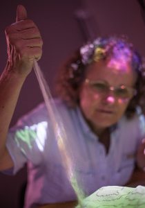
Using their hands, shovels and flat boards, students can manipulate the sand to create hills, rivers, lakes and other features. Placing a hand at a certain height above the sand simulates a cloud and makes it rain, generating realistic water flows and filling low-lying depressions.
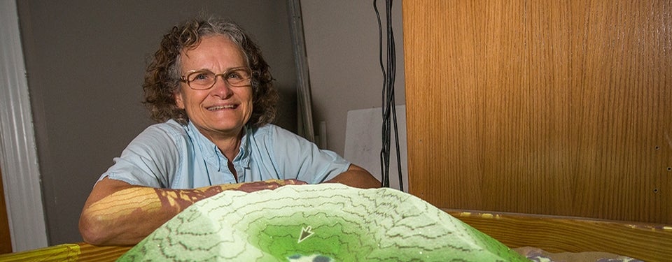
Dr. Terri Woods, associate professor of geology, said the primary use of the AR sandbox so far has been to teach students in introductory geology labs how to interpret topographic maps. The lab, she says, fulfills a science requirement for students who are not geology majors, so many of them have a limited science background.

A projector and an Xbox Kinect camera create a closed loop that displays contour lines, elevations and water flows on the sandbox landscape.
“We would spend four weeks in that lab, having them work with paper topographic maps, and 90 percent of the students come out of there, and it’s still just lines on a piece of paper,” she said. “They can never get from the 2-D topographic map to what the terrain actually looks like.”
The AR sandbox facilitates that understanding by providing a 3-D representation of the landscape that can be altered and manipulated to see how the changes are portrayed on the map.
“I start off by explaining contour lines to them, and I can do it by getting them to kneel down right here and look at these lines, and see that if they follow one, it stays at the same height all the way around,” Woods said. “If the terrain is gently sloped, the lines are farther apart compared to where it’s more steep.”
On a paper topographic map, she said, it is difficult for students to figure out which way a stream flows. The contour lines form Vs in the streambed that point upstream. In 3-D in the sandbox, it’s a simple concept to demonstrate.
She can then assign a group of students a simple topographic map and have them recreate it in the box.
“Then we start building things, like a model of the Outer Banks, showing Oregon Inlet,” she said. “Or make a river with meanders and a cutoff, or an oxbow lake. We can show what a shoreline looks like at high tide versus low tide.”
The way waveforms bend along a shoreline is another concept that was difficult to illustrate before the sandbox.
“It’s a very sophisticated hydrodynamic program, and this bending of waves as they come in and approach the shore at an angle, and bend toward the shore, that’s what causes undertow – which transports huge amounts of sand and has a huge impact on coastal features,” Woods said. “And students can never see that; well, you can see it right there.”
Woods learned of the idea from her husband, John, lab technician for the geological sciences department, who had seen a video of an early version online. “That was his big mistake,” she said, “because then he ended up having to build it. When we saw it, it was obvious to me right away that it would be a big help.”
Using a very loose set of construction guidelines and the open-source software, which runs on Linux, John and his son, Michael, a systems engineer at Carolinas IT, built two of the sandboxes – and spent the better part of a day working out bugs in the software.

The system reacts to changes in the terrain almost instantly.
Woods has since taken the AR sandbox on the road to demonstrate at events such as Science Olympiad, high school STEM days, the Aurora Fossil Festival and a meeting of the Geological Society of America. From kids to adults, Woods said, everyone wants to play in the sandbox.
“Imagine if you started elementary kids with this and just let them play,” she said. “After a few hours they would know what those lines were telling them, without anybody having to explain it.”
Woods, with the help of Sarah Reed of the University of California, Berkeley and Sherry Hsi of the Concord Consortium, has authored a paper on the use of the tool in geology labs, detailing everything about the process from lesson plans to student feedback.
Kristen Daniel, a rising senior music major, was among the first students to use the AR sandbox.
“I found it very helpful to see contour lines actually applied to something three-dimensional rather than looking at them on a map,” she said. “We all thought it was a really cool tool that none of us had ever used before, and it was really fun to experiment with it.”
Daniel added that it would be a great way to get middle school and high school students more interested in science and geology, which is exactly what Woods has in mind. She is working on generating funding for a pilot program that would place AR sandboxes in middle school and high school classrooms.
Newer versions of the software have less bugs and add features, like lava flow and groundwater, already built in. “Something that would take days or weeks for us to program ourselves, just comes right up,” John said.
Other members of the faculty are thinking about different applications and how to use the sandbox in their own classes and labs, Woods said.
She could see the technology being useful in explaining geologic concepts outside the classroom as well. “It could help an awful lot of people,” she said. “Geologists do a lot of work with city managers and regulators, and have to try to explain natural processes to them. You could take this to the city council and talk to them about stormwater runoff.”
Overall, Woods said, the pilot study suggests that the AR sandbox can be a powerful tool for bridging the gap between 2-D representations and real landscapes, enhancing spatial thinking and modeling abilities. The feedback from students who have played – and learned – with the sandbox has been overwhelmingly positive.
