Riverbank erosion in Bangladesh
In North Carolina, coastal communities are faced with environmental change as water interacts with the land. Sea level rise and storm surges are the primary threats, but an understudied issue in Bangladesh may help provide N.C. coastal communities with a model for resiliency.

On the banks of the Meghna River, a village in Bangladesh uses a concrete block wall to protect the village from further river bank erosion. (Contributed photos.)
Citizens of Bangladesh live on a delta and also must contend with the power of the Meghna River, which flows in response to monsoon rainfall. While excess rains can lead to flooding in both eastern North Carolina and Bangladesh, riverbank erosion is a unique challenge for Bangladesh.
This multifaceted problem is understudied, but members of an expert panel funded by the National Science Foundation will address this issue at East Carolina University.
ECU will host “Geospatial Science, Human Geography and Atmospheric Science for Coastal Research: Understanding and Predicting Riverbank Erosion in Bangladesh,” at 3:30 p.m. Friday, April 20, in the Science and Technology Building, Room C-209.
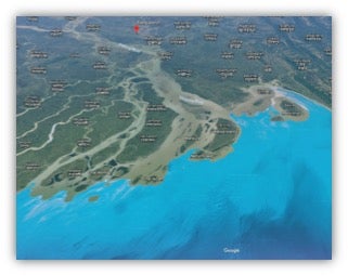
Bangladesh coastal map
Dr. Scott Curtis, ECU professor of atmospheric science in the Department of Geography, Planning and Environment and one of the event panelists, said, “In Bangladesh, people are caught between geologic and climate drivers and local land loss, which is permanent and can be so severe that entire villages may be wiped out in a year or two.”
During the event, panelists will discuss their interdisciplinary research experiences, focusing on the potential benefits of local adaptation measures and large-scale climate prediction for enhanced resiliency at the coast.
“Our project will add to the current understandings of vulnerability, resilience and adaptation related to coastal erosion,” said Curtis.
Curtis said the average erosion rate for the area they are studying in Bangladesh is 100 meters per year. If that was translated to the Outer Banks, he said it would be underwater in fewer than 50 years.
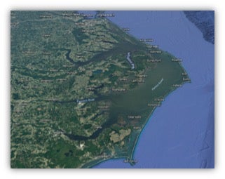
N.C. coastal map
“The rates of erosion are much higher in Bangladesh than North Carolina,” Curtis said, “which means that social adjustments, recoveries and resettlements occur rapidly and may be a model for our area where accelerated sea level rise is predicted to be a consequence of climate change.”
Curtis will be joined on the panel by Dr. Bimal Paul from Kansas State University; Dr. Kahled Rahman from Virginia Tech; and Dr. Tom Crawford, professor and chair of the Department of Geography at Virginia Tech and former ECU faculty member, who will lead the panel.
The event is free and open to the public. It is co-sponsored by The Thomas Harriot College of Arts and Sciences and the Department of Geography, Planning and Environment as part of the THCAS Advancement Council Distinguished Professorship in Natural Sciences and Mathematics held by Curtis.
For additional information contact Curtis at curtisw@ecu.edu.
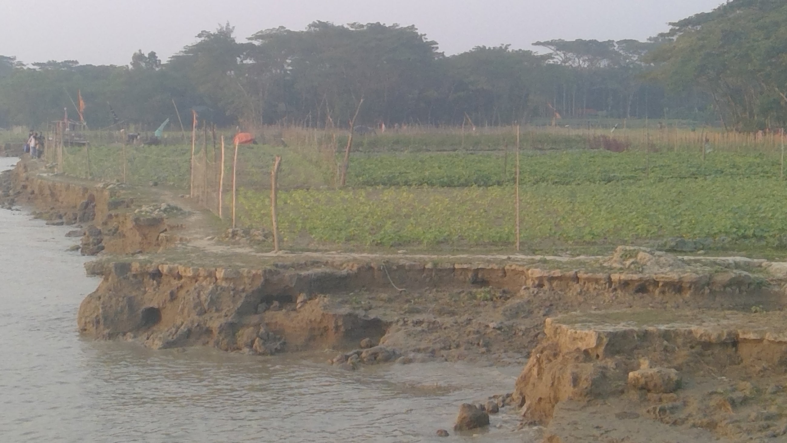
Seen here on the banks of the Meghan River, river bank erosion encroaches on farm fields.
-by Lacey L. Gray, University Communications